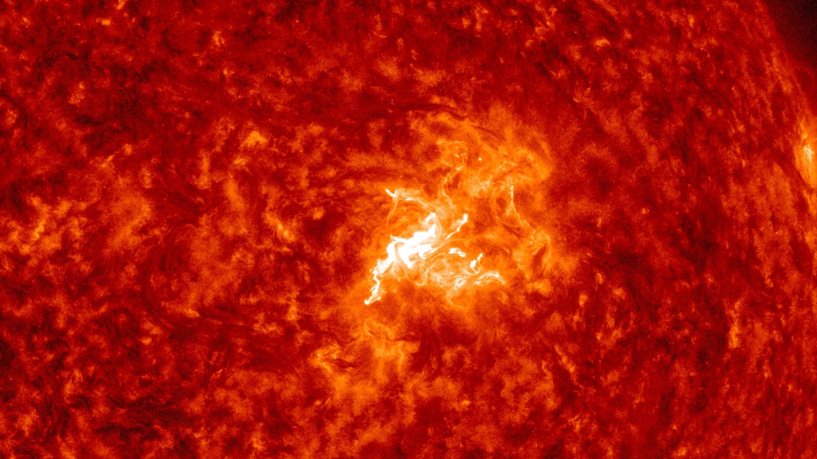
Just before noon Eastern on Thursday, a tangled knot of sunspots near the middle of the Sun flashed brighter than anything it had produced all week.
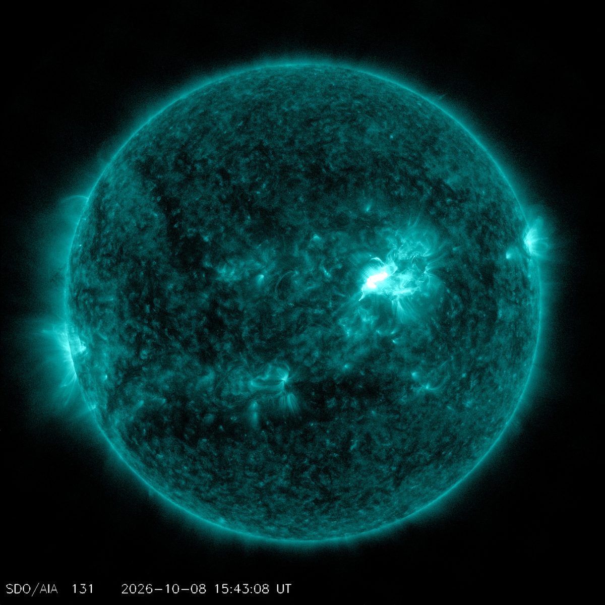
The flare peaked at 11:48 a.m. ET on October 8. NOAA’s Space Weather Prediction Center classed it as an M6.7, a strong flare in the M class, which sits one step below the most powerful X-class flares. It came from sunspot Region 4549, the same group that launched the cloud expected to brush Earth tonight. Now NASA analysts say this flare launched a cloud of its own.
What happened at 11:48
The flare began at 11:29 a.m. ET and was over by 11:58 a.m. ET. NOAA logged it at N12W20, a spot close to the center of the Sun’s Earth-facing side. Its burst of X-rays caused an R2 (Moderate) radio blackout: a limited loss of high-frequency radio on the sunlit side of Earth for tens of minutes. That part is already over. X-rays travel at the speed of light, so they arrive in about eight minutes and fade when the flare fades.
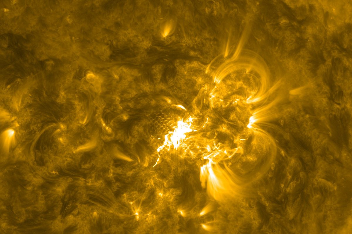
NOAA describes Region 4549 as a beta-gamma-delta sunspot group. In plain terms, its opposite magnetic polarities are packed tightly together, which is the kind of setup forecasters watch for bigger flares. In its 6 p.m. ET report Thursday, NOAA raised the odds of more M-class flares to 55% per day through Oct. 11, with a 10% daily chance of an X-class flare.
Did it send a cloud toward Earth?
A flare and a coronal mass ejection (CME) are different things. The flare is the flash of light. A CME is a cloud of magnetized solar material that can weigh billions of tons, and it can take days to cross the 93 million miles to Earth. Only a CME can trigger a geomagnetic storm and push the northern lights south.
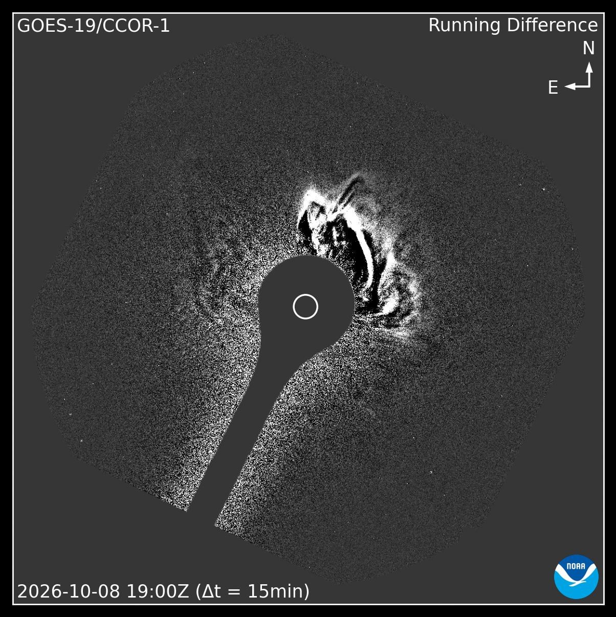
This time there was one. NASA’s space weather database, DONKI, links a CME to the M6.7 flare. It was first spotted at 12:53 p.m. ET by the STEREO-A spacecraft’s coronagraph, and to the northwest in NOAA’s GOES-19 coronagraph. NASA analysts also noted a wave of disturbance that rippled across the whole northwest quarter of the Sun’s Earth-facing disk.
When could it arrive?
NASA’s models (preliminary): NASA ran its WSA-Enlil solar wind model several times Thursday afternoon as analysts refined the cloud’s speed. An early run, using a preliminary speed of about 723 km/s (roughly 1.6 million mph), put the arrival near 5 a.m. ET Sunday, Oct. 11. A slower updated measurement, about 504 km/s, pushed it later. The newest run, finished at 6:21 p.m. ET and including both of Thursday’s CMEs, puts the arrival around 4:15 p.m. ET Sunday, with an estimated Kp of 3 to 5. On NOAA’s scale, Kp 5 is a G1 (Minor) storm.
NOAA’s forecast: NOAA’s geomagnetic forecast, issued at 6:05 p.m. ET Thursday, now calls for Kp 5 (G1, Minor) from 11 p.m. Saturday to 2 a.m. Sunday ET, with active levels on either side. A joint NOAA/U.S. Air Force report issued at 6 p.m. ET expects “quiet to minor storm levels” on Oct. 11. NOAA hasn’t issued a storm watch for the weekend. Its products don’t yet say which cloud is behind the Saturday-night forecast. NOAA’s Thursday-morning discussion, written before the M6.7 flare, tied an early Oct. 11 (UTC) arrival to Wednesday’s CME. NOAA’s next forecast discussion is expected around 8:30 p.m. ET.
So the two agencies don’t line up perfectly yet. NOAA’s forecast points to Saturday night. NASA’s newest run for Thursday’s clouds points to Sunday afternoon.
Those are computer models, and they come with hours of uncertainty either way. How strong a storm gets depends most on the cloud’s magnetic orientation. Nobody can measure that until the CME passes the monitoring spacecraft about a million miles upstream, roughly 15 to 60 minutes before it hits Earth.
A crowded weekend for space weather
Today’s CME isn’t the only one heading this way. Region 4549 has been busy all week.
Tonight, the Oct. 6 CME: This is the one NOAA’s G2 watch is for. As of 6:35 p.m. ET it hadn’t arrived. NOAA’s real-time solar wind data still showed calm conditions, around 350 km/s.
Wednesday, the Oct. 7 CME: It followed a C7.9 flare from the same region. NOAA said Thursday morning that part of it should reach Earth early on Oct. 11 (UTC), which is Saturday evening or night in the eastern U.S. NASA’s model has it as a glancing blow around 2 a.m. ET Sunday.
Thursday, two more: Besides the M6.7 cloud, NASA logged a separate CME from a filament eruption near the middle of the Sun’s Earth-facing side. It was first seen at 12:24 p.m. ET, moving about 579 km/s. NASA’s newest model run includes both of Thursday’s CMEs together.
What it could mean for the northern lights
For now, the solid forecast is tonight’s. NOAA’s G2 (Moderate) watch for Oct. 9 still stands for the CME that left on Oct. 6. Our northern lights guide for tonight has the viewing windows and tips.
NOAA’s 6:05 p.m. ET update moved tonight’s strongest window a bit earlier. It now forecasts Kp 5 (G1) from 11 p.m. to 2 a.m. ET, a possible G2 peak (Kp 5.67) from 2 to 5 a.m. ET Friday, and Kp 5 again from 5 to 8 a.m. Timing can still shift by hours.
Sunday is a maybe on top of a maybe. If NASA’s model runs hold and the magnetic fields line up, the weekend could bring another chance at aurora, most likely in the far northern U.S. If they don’t, it could pass with little more than unsettled conditions. Keep an eye on NOAA’s forecasts over the next two days.
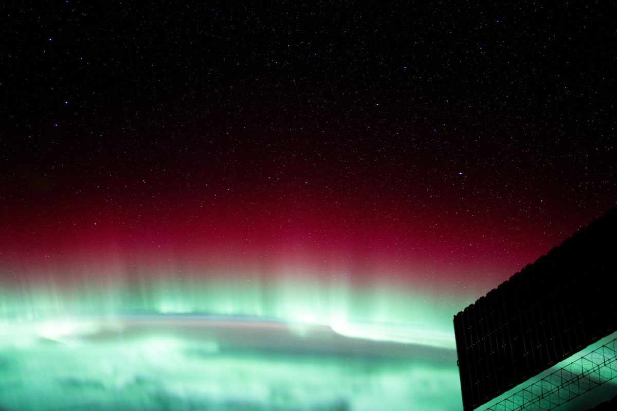
The Sun’s light from that flare reached us in eight minutes. The cloud behind it will take days. That gap is the waiting game of space weather, and this weekend the waiting may pay off.
No Ground. Stay curious.